Most articles about the Caprivi (now the Zambezi region) tell you it's worth visiting and stop there. This is the next layer down: the operational drive from Rundu in the west to Katima Mulilo in the east, where to actually overnight inside the strip, where the fuel and signal gaps are, what the border-adjacent driving etiquette is, and what to expect from each of the four parks (Bwabwata, Mudumu, Nkasa Rupara, plus the Mahangu access). The Caprivi is not difficult to self-drive, but it is the one region in Namibia where almost everything operates differently — including the rules of the road, the wildlife behaviour, and the lodge bookings.
On this page11What this guide is not · The geography in one paragraph …
- 1.What this guide is not
- 2.The geography in one paragraph
- 3.Getting to Rundu: the gateway question
- 4.Segment-by-segment: Rundu → Divundu (B8, ~200 km, ~2h15)
- 5.Segment-by-segment: Divundu → Kongola (B8, ~200 km, ~2h15)
- 6.Segment-by-segment: Kongola → Katima Mulilo (B8, ~120 km, ~1h30)
- 7.The four parks in driving order
- 8.Border-adjacent etiquette that no one tells you about
- 9.Fuel and signal: the real map
- 10.The honest minimum: 3 nights inside the strip plus 2 transfer days
- 11.When the Caprivi self-drive is wrong for you
What this guide is not
Not a romantic walk-through of every lodge along the river. It's the operational drive — distances, fuel, road condition, the parks in order, the border etiquette that travellers rarely read about beforehand, and the honest sequencing for a first Caprivi self-drive.
If you read one section, read 'The four parks in driving order' below — it decides where you sleep and which days you have wildlife.
Quick check
Is this you?
The geography in one paragraph
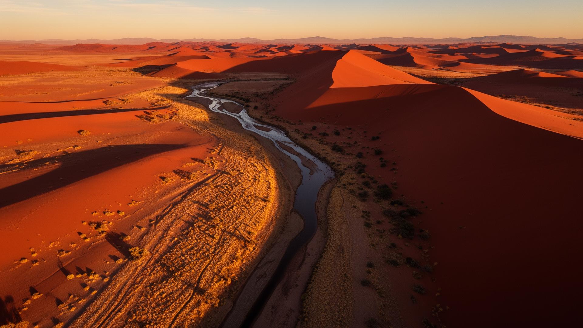
The Zambezi region (still called Caprivi by almost everyone, including locals) is the long thin strip of Namibia pushing east between Angola in the north, Botswana in the south, and Zambia at the eastern tip. It's 450 km long and rarely more than 100 km wide. The B8 tar road runs through it like a spine. Four major parks sit along that spine — Bwabwata in the west, then Mahangu (technically just outside the Bwabwata boundary), then Mudumu and Nkasa Rupara to the south. The strip is fed by the Okavango, Kwando, Zambezi, and Chobe rivers, which is why it is greener and wetter than the rest of Namibia by an order of magnitude.
Getting to Rundu: the gateway question
Rundu is the western entry to the Caprivi and the natural start of the strip. From central Namibia (Etosha or Tsumeb), Rundu is ~370 km on tar via Grootfontein — a 4-hour drive on the B8. From Windhoek directly, it's ~720 km, a full driving day (~8h). Most travellers come via Etosha and break the journey at Roy's Camp or Hakusembe River Lodge.
The faster alternative for travellers continuing into Botswana is to fly into Kasane (Chobe airport, Botswana) and reverse the strip east-to-west. We rarely recommend it for first-timers because the Caprivi works better as a 'reward' for finishing the classic loop than as an arrival.
Segment-by-segment: Rundu → Divundu (B8, ~200 km, ~2h15)
Tar throughout, generally good condition. The B8 runs parallel to the Kavango River — you rarely see the river from the road, but the population density tells you it's there: villages, donkey carts, school children, livestock crossings. This is the section where most accidents happen, because travellers treat the B8 like a Namibian tar road (i.e. empty). It is not.
- Speed limit posted as 120 km/h. Real comfortable speed is 90–100 because of livestock and pedestrian traffic.
- Fuel and supermarket at Rundu (full tank). Next reliable fuel is Divundu (~200 km).
- Avoid driving after sunset on this segment. Livestock and dark clothing make pedestrians invisible at dusk.
- Police checkpoints near Mukwe and again before Divundu. Slow to walking pace, greet the officer, have your driving licence visible. Usually waved through in under a minute.
Segment-by-segment: Divundu → Kongola (B8, ~200 km, ~2h15)
This is the heart of the Caprivi drive. The B8 crosses the Okavango River at Divundu (where you decide whether to detour south to Mahangu), then runs through the western half of Bwabwata National Park for nearly 200 km. You will see elephants on the road. Not might. Will.
- Bwabwata transit (tar through the park, no entry fee for transit drivers). Speed limit drops to 80 km/h inside the park. Respect it — elephants step out of the bush without warning.
- If you see elephants on or near the road: stop the car 100 m back, engine off, wait. Do not honk, do not drive past slowly. They will move when they're ready.
- Fuel at Divundu (full tank). No fuel between Divundu and Kongola (180+ km). The Engen at Kongola is small but reliable.
- Kwando River bridge at Kongola — the geographic transition into the eastern Caprivi. The character of the strip shifts here: more water, more wildlife density, the lodges get better.
Segment-by-segment: Kongola → Katima Mulilo (B8, ~120 km, ~1h30)
Final stretch of the B8. Tar, generally fast, occasional villages. Katima Mulilo is the eastern capital and the border town for crossings into Zambia (Sesheke) and onward to Livingstone or Victoria Falls. It's also the only town in the strip with a real supermarket (Pick n Pay), full-service fuel, and ATMs that consistently work.
Most travellers stay at one of the river lodges on the Zambezi outside Katima (Caprivi River Lodge, Zambezi Mubala Camp, or one of the smaller camps upriver) rather than in town itself. Town is functional, not scenic.
The four parks in driving order
Wildlife in the Caprivi is concentrated, not spread. Pick your overnights by the park you want to visit, not by 'how far along the strip we got today'.
- Bwabwata West (around Popa Falls, near Divundu). Elephant and buffalo along the Okavango, good birding, gentle game drives. Stay at Nunda River Lodge, Mahangu Safari Lodge, or Ngepi Camp. 1–2 nights.
- Mahangu Game Reserve (south of Divundu on the C48). Small but dense — elephant, hippo, sable, roan antelope. Self-drive accessible, fee at gate. Easy day trip from a Divundu-area lodge.
- Mudumu National Park (south of Kongola on the D3511 gravel). Wilder, less-visited, classic Caprivi wetland wildlife. Lianshulu Lodge or Camp Kwando are the practical bases. 2 nights ideal.
- Nkasa Rupara (formerly Mamili, further south on gravel). Namibia's largest wetland park, seasonal access (often unreachable in the rainy season Jan–Mar). Lagoon hides, hippo, elephant. For the second-time Caprivi visitor.
Border-adjacent etiquette that no one tells you about
The Caprivi sits against three international borders. The driving etiquette around them is unwritten but real, and getting it wrong creates problems that are tedious to unwind.
- Do not photograph border posts, immigration buildings, military installations, or police checkpoints. This includes the bridge at Sesheke and the Wenela border post. A confiscated phone is a long afternoon at best.
- At police checkpoints, slow to walking pace, lower your driver's window, greet the officer first ('Good afternoon'), have your driver's licence and passport accessible. Be calm and brief. You will almost always be waved through.
- Bribes are not normal in Namibia and not expected. If an officer suggests one, politely decline and ask for a written notice — that almost always ends the conversation.
- If you are continuing into Zambia, Botswana, or Zimbabwe, you need a cross-border letter from your rental company (request it when booking, not at the border). You also need third-party insurance valid for the destination country — check before you arrive at the border.
- Vehicle searches at borders are normal and not personal. Open compartments when asked. Keep all receipts for purchased game meat or fish — possession without paperwork is technically poaching.
Fuel and signal: the real map
Reliable fuel: Rundu, Divundu (Mukwe), Kongola, Katima Mulilo. Top up at every one regardless of gauge. The Caprivi is not the country to test fuel range.
Mobile signal: solid in Rundu and Katima Mulilo, patchy in Divundu and Kongola, gone inside the parks and on most gravel side-roads. MTC is the dominant network; CellOne is weaker. Download offline maps for Kavango East, Kavango West, and Zambezi regions before leaving Rundu.
ATMs: reliable in Rundu and Katima Mulilo. Carry enough cash for park fees (currently N$80–150 per adult per day for foreign visitors at most Zambezi parks) and tips. Many lodges accept cards; many camps do not.
The honest minimum: 3 nights inside the strip plus 2 transfer days
Below 3 nights inside the strip, the Caprivi becomes a transit experience — you have driven 1,200 km round-trip for two waterhole afternoons. Not worth it.
Our minimum-shape recommendation: 1 night near Rundu (transfer), 1 night Bwabwata West/Mahangu area, 2 nights Mudumu area, 1 night Katima/Zambezi. Plus a transfer day back to central Namibia or onward to Botswana/Vic Falls. That's a 6-day Caprivi block.
Stretch it to 8 days if you want to add Nkasa Rupara or a Chobe day trip from Katima. Compress to 4 days only if you are doing Caprivi as a bridge into Victoria Falls and will rest there.
When the Caprivi self-drive is wrong for you
On a 7- or 10-day Namibia trip. The Caprivi requires geographical room. Adding it to a short trip means cutting Etosha, Damaraland, or Sossusvlei — almost never the right trade.
If you are nervous about wildlife in close proximity. The Caprivi has elephants on tar roads, hippos in camp pools, and crocodiles in the rivers your lodge is on. The risk is small but real and the protocol matters.
In the deep rains (January–March) on the southern gravel routes. Nkasa Rupara becomes inaccessible, Mudumu side-roads can flood, and even the main B8 has occasional washed-out culverts. Best dry-season experience is May to October.
Frequently asked questions
How long does it take to drive the Caprivi end-to-end?
About 6 hours moving time from Rundu to Katima Mulilo on the B8, all tar. With fuel stops, wildlife stops in Bwabwata, and police checkpoints, plan 7–8 hours if doing it in one push (which we don't recommend).
Is the Caprivi safe to self-drive?
Yes, with normal Namibian driving discipline plus three Caprivi-specific habits: do not drive at night (livestock, pedestrians, wildlife), respect elephants on the road by stopping and waiting, and treat police checkpoints with calm courtesy.
Do I need a 4x4 for the Caprivi?
Not for the main B8 corridor. A 2WD sedan handles all the tar and most lodge access roads in the dry season. You need a 4x4 only if you want to explore the gravel deep into Mudumu or Nkasa Rupara, or in the wet season.
What's the best time to drive the Caprivi?
May to October (dry season) is the most reliable — roads are firm, wildlife concentrates at the rivers, and lodges are fully operational. April and November are good shoulders. December–March can be brilliant for birding and dramatic landscape but parts of Nkasa Rupara and southern gravel routes are inaccessible.
Can I cross into Botswana or Zambia from the Caprivi?
Yes. The main crossings are Ngoma (into Botswana, towards Chobe and Kasane) and Wenela/Sesheke (into Zambia, towards Livingstone and Victoria Falls). Both require a cross-border letter from your rental company and third-party insurance for the destination country — arrange before you leave.
Final verdict
Driving the Caprivi end-to-end is the strongest way to see the most unusual part of Namibia. It is not difficult. It is just different — different wildlife behaviour, different road etiquette, different lodge style, different rules about borders and checkpoints. Get the sequencing right (Rundu in, Katima out, three nights inside the strip minimum), top up fuel at every town, and treat the elephants on the B8 with the patience they deserve. If you want this routed into a real Namibia trip — including how it connects to Etosha, Botswana, or Victoria Falls — that's the part we plan from scratch, not from a template.
Devin, Inside Namibia· Based in Swakopmund · travel & regulations
I'm the one our team turns to when a question starts with "are we actually allowed to…". I've spent years tracking how Namibia's travel rules, park regulations, customs procedures, and cross-border paperwork actually work in practice — not just what the official page says. If a plan touches a permit, a border, a fee, or a rule that just changed, it usually crosses my desk.
Most Caprivi trips need the whole route reshaped, not just reviewed
Adding the Caprivi usually changes Etosha night-splits, Botswana timing, and the return leg. We plan the whole shape — region by region, night by night — around your dates and priorities.